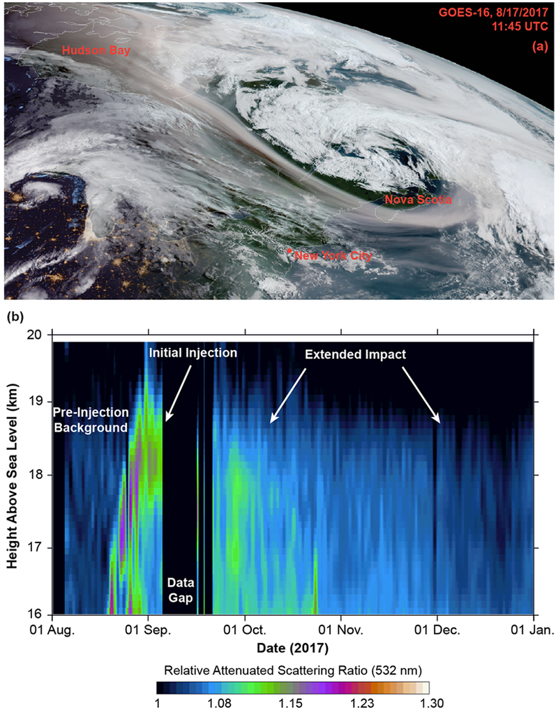
Fig. 4.

Stratospheric smoke transport and residence time. Top panel shows true color imagery from the GOES-16 GeoColor Algorithm (developed by CIRA) near sunrise on 17 August 2017 (11:45 UTC). The stratospheric smoke plume extends from Hudson Bay to the northern Atlantic Ocean. Bottom panel provides a time series of CALIOP relative attenuated 532 nm scattering ratio averaged over the Northern Hemisphere between 40°N and 80°N. The gaps in the time series represent CALIOP data outages in early August and mid-September 2017
