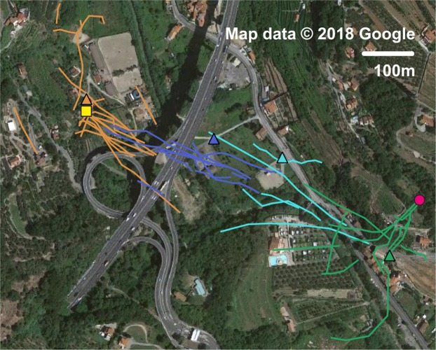
Figure 5.
Georeferenced tracks of the Asian hornet near Finale Ligure, in the inland of Liguria in Italy. The satellite image is taken from Google maps (www.google.it/maps, map data: Google) and loaded with QGIS (www.qgis.org/en/site). The positions of the entomological radar are indicated by coloured triangles on the map; the hornets’ tracks recorded for every position are characterized by the same colour. The beehive and the hornets’ nest are marked out with a yellow square and a pink circle respectively. This picture is under the terms of the GNU Free Documentation License, Version 1.3.

