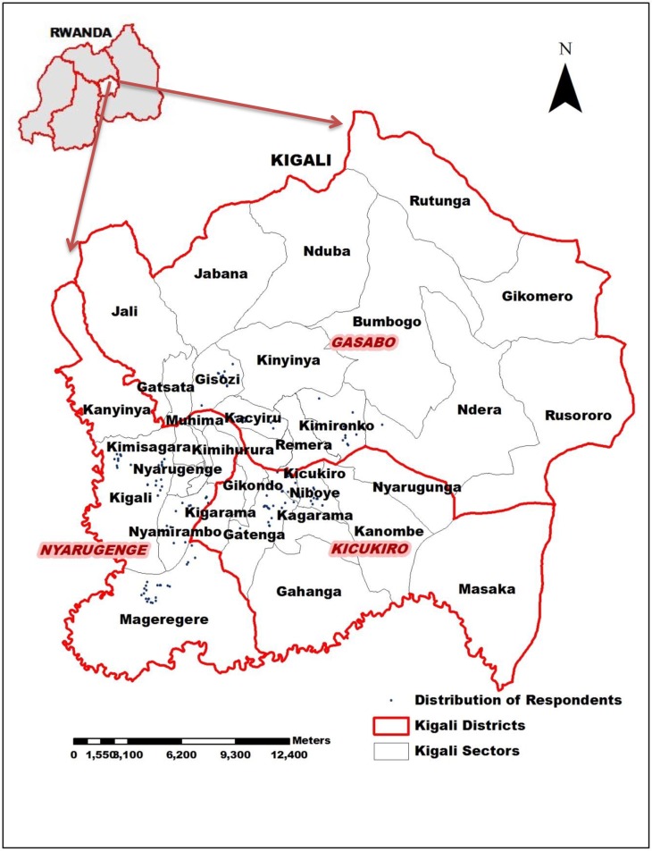
Fig 1. “Fig 1” illustrates names of the three administrative districts of Kigali city which are coloured in red, while those of its administrative sectors are coloured in gray.
The blue points represent the respondent homes. The nine study sectors are Mageragere, Nyamirambo and Kigali in Nyarugenge district; Gatenga, Niboye and Kicukiro in Kicukiro district, and Kacyiru, Kimironko and Gisozi in Gasabo district. During this study, GPS data were collected on the location of each respondent’s household. ArcGis10.2 software was used to produce the map based on the GPS data.

