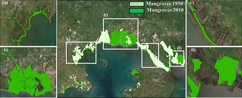
Fig 2. Mangrove cover in Pagbilao (The Philippines).
Mangroves extent in 1950 and 2010 in Pagbilao municipality, zooming in four different areas with different mangrove covert development: (a) Mangroves retreat may be due to a change in the river sediment transport in the west side of the municipality, (b) mangroves density increment due to restoration policies, (c) mangroves conversion into aquaculture areas and (d) mangroves migration in the east side of Pagbilao. Reprinted from ArcGIS Online maps under a CC BY license, with permission from Esri, original Copyright 2018 Esri (Basemaps supported by Esri, DigitalGlobe, GeoEye, Earthstar Geographics, CNES/Airbus Ds, USDA, AEX, Getmapping, Aerogrid, IGN, IGP, swisstopo, and the GIS User Community).

