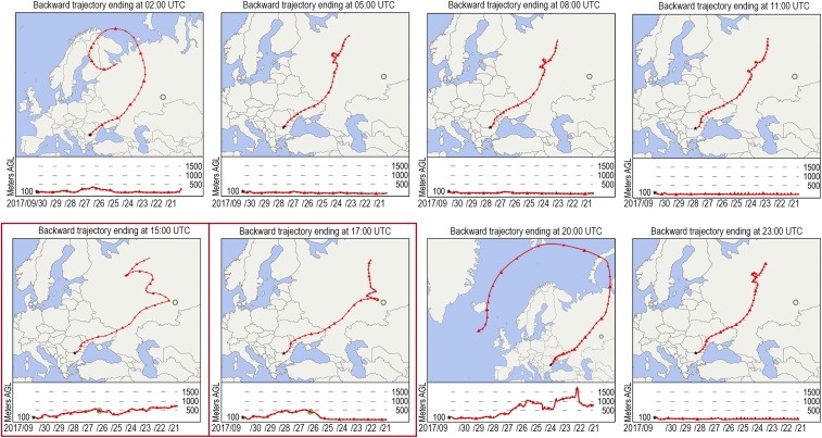
Fig. 5.
HYSPLIT-based 240-h backward trajectories ending at the Romanian monitoring station in Zimnicea (black star) (43.666 N, 25.666 E), every 3 h on September 30, 2017, from 2 AM to 11 PM UTC. The National Oceanic and Atmospheric Administration (NOAA) HYSPLIT model uses Global Data Assimilation System (GDAS) meteorological data. The Model Vertical Velocity was used as vertical motion calculation method. The green circle indicates the position of the Mayak industrial complex. The altitude of the air parcels is given in meters above ground level (AGL). The green circle in the altitude sections of the trajectories ending at 3 PM and 5 PM UTC (maps surrounded by red frames), respectively, indicates the time and altitude (approximately 500 m) the air parcels were in closest proximity to the Mayak area.

