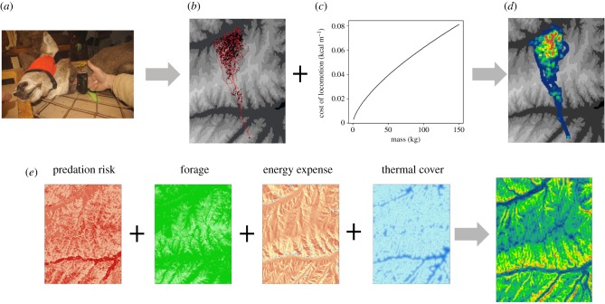
Figure 5.
Deriving a fitness landscape from combined movement and landscape data can be achieved using two general approaches. In the upper pathway, individual animals are collared (a) and ancillary information (e.g. body condition) is collected. The data provide movement paths (b) that can be coupled with information on the metabolic costs of movement (c) to produce estimates of the location-specific energetic cost for the animal (d), a proxy of the fitness landscape. In the lower pathway (e), ancillary (e.g. remote sensing) or modelled movement data are used to create landscape-level layers of fitness components (e.g. predation risk, forage availability, energy expenditure and thermal cover). Aggregation of these layers provides a more comprehensive estimate of the fitness landscape.

