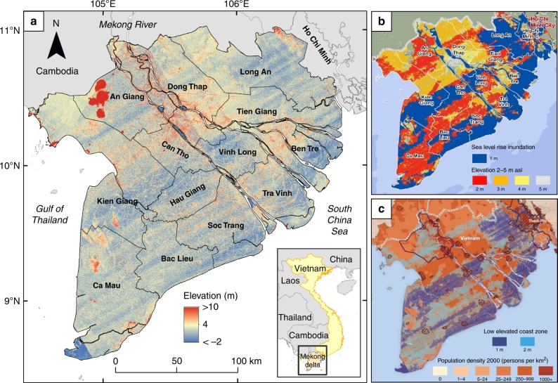
Fig. 1.
Spaceborne elevation of the Mekong delta and derived inundation maps. a Shuttle Radar Topography Mission (SRTM) Digital Elevation Model (DEM) of the Mekong delta in Vietnam. b, c Inundation maps following sea-level rise based on the SRTM DEM containing effects of striping and other height errors. b Inundation zones with meters sea-level rise29, copyright by 2008 ICEM. Used by written permission. This map was included in several policy documents, amongst others, the Asian Development Bank36, Mekong River commission technical paper32; World Wildlife fund risk assessment Mekong34 and the Dutch-Vietnamese Mekong Delta Plan35, which is now a leading document for major Worldbank projects in the delta. c Low elevated coast zones with population density30,38, copyright by 2008 CARE International and UN University. Used by permission. This map was included in, amongst others, the risk assessment Mekong by the World Wildlife Fund34

