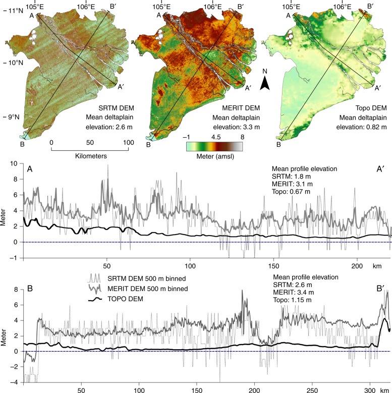
Fig. 3.
Digital elevation models of the Mekong delta with elevation profiles. The elevation profiles of the SRTM and MERIT Digital Elevation Models (DEMs) was binned (mean elevation) in 500-m segments to match the spatial resolution of the Topo DEM to allow visual comparison. Mean elevation of the DEMs was calculated for the delta plain only, excluding the higher elevated bedrock outcrops in the northwest of the delta. Supplementary Fig. 3 is a color-blind-friendly version of this figure

