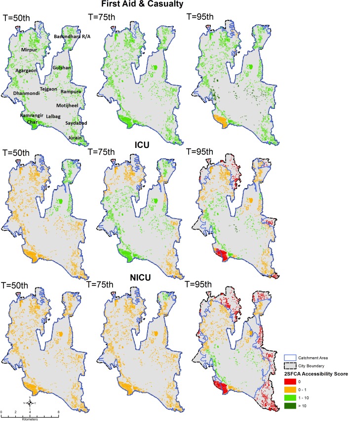
Fig 3. Geographic accessibility to First Aid & Casualty, ICU, and NICU emergency units in Dhaka city using a 60-minutes travel time threshold and different traffic scenarios characterized by different transit times percentiles (T).
Slums are color coded based on the spatial accessibility scores output of the 2-step floating catchment area method, expressed in units of nr of emergency units per 50,000 population. Blue polygons indicate the merged extent of the 60-minutes catchment areas of individual services (note that catchment areas are clipped to City Corporation extent).

