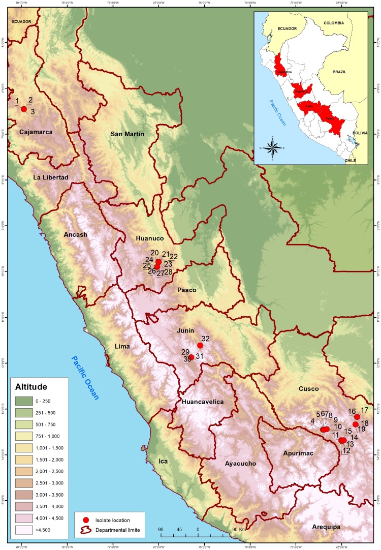
Figure 1.
Map of potato sample collection sites in the Andean Highlands of Peru showing where PVY was detected (red spots). The numbers clustered around each collection site in this Figure indicate where each individual infected sample came and correspond to those in Table 1. The names marked on the map are those of the countries regional departments (red lines are departmental boundaries). Inset shows an outline map of the entire country and neighboring regions of the five countries with land borders.

