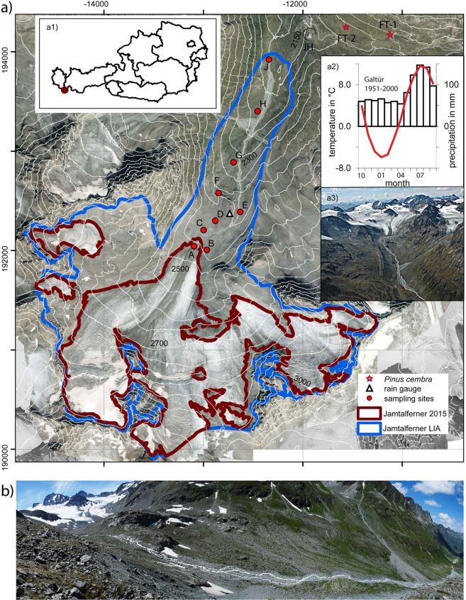
Figure 1.
(a) Extent of Jamtalferner at LIA maximum (blue line) and in 2015 (red line) as well as contour lines (DEM of 2006; source: Land Tirol - data.tirol.gv.at CC BY 4.0) superimposed on an orthophoto from August 2015. Red dots indicate vegetation sampling sites A to J in 2016. The three subsites (I, II and III) for each sample location are close to each other, so that only one symbol is displayed at the averaged positions of the subsites. JH indicates the location of Jamtal hut, FT1 and FT2 indicate the discoveries of fossil Pinus cembra trees. Inserts: (a1) location of Jamtalferner within Austria, (a2) mean monthly temperatures and precipitation at the station of Galtür, and a3) photo of the upper part of Jamtalferner (2006, A. Fischer). (b) Panoramic view of the glacier foreland of Jamtalferner between the current and the LIA terminus (2018, A. Fischer).

