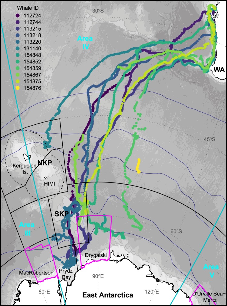
Figure 1.
Southern Ocean migration pathways for humpback whales satellite-tracked off the western coast of Australia showing the full extent of southbound tracks. Individual whales (n = 12) are represented by colour. Relevant IWC Management Areas III, IV, and V, (demarcated at 70° and 130°E) are shown in turquoise. Three areas for an East Antarctic Representative System of Marine Protected Areas proposed by Australia, the European Union and its Member States are shown in magenta: MacRobertson, Drygalski and D’Urville Sea–Mertz. Black line vectors show the CCAMLR Statistical areas (https://gis.ccamlr.org/), and the Exclusive Economic Zones (dashed lines) around the Kerguelen Islands (France) and Heard Island and MacDonald Islands (HIMI, Australia). The climatological positions of the major ACC fronts90 are shown in navy. Background shading shows bathymetry91. Abbreviations: NKP – northern Kerguelen plateau; SKP – southern Kerguelen plateau; WA – Western Australia.

