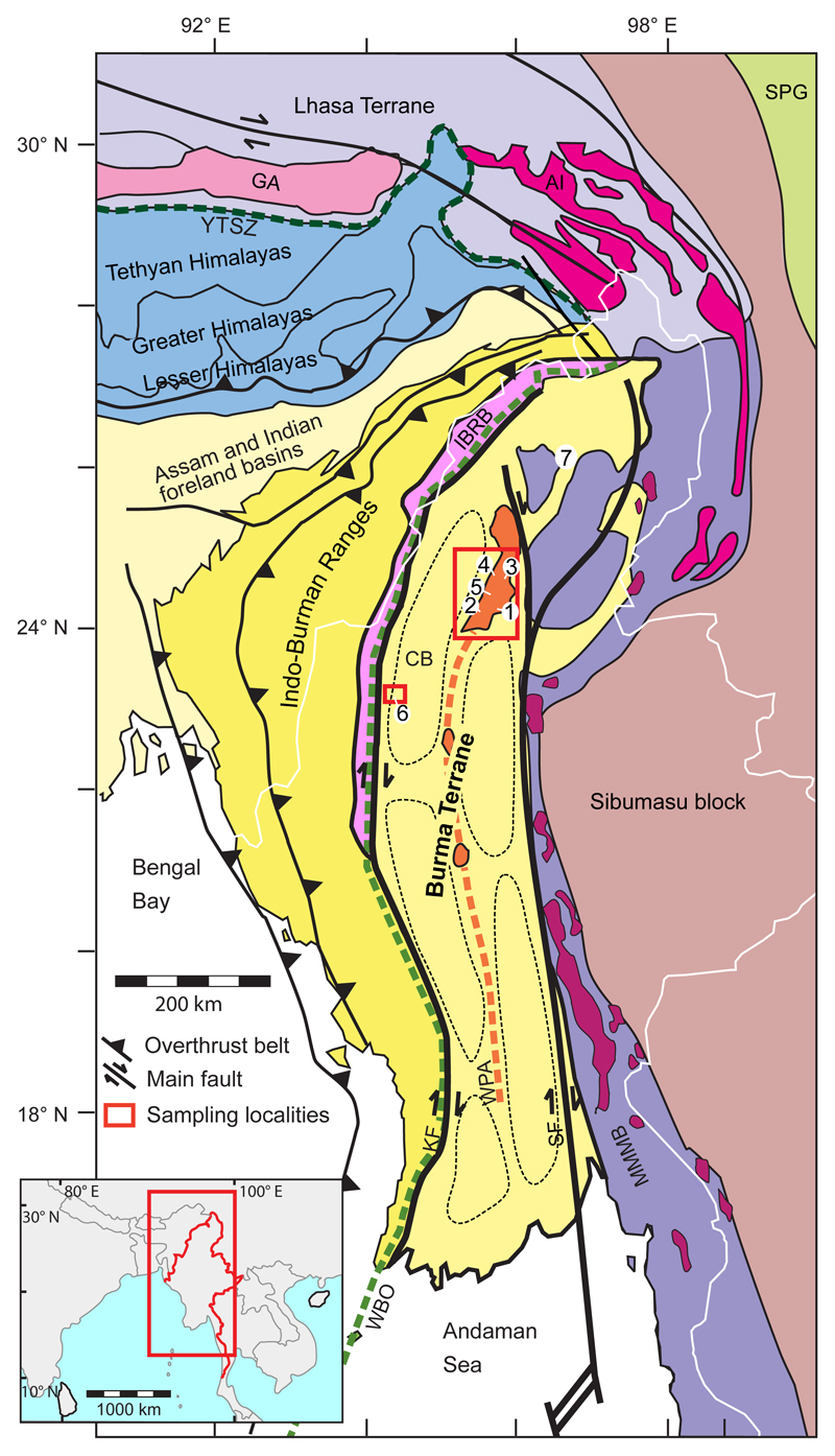
Figure 2.
Generalized Myanmar geologic map 21. Localities: 1 = Kawlin, 2 = Pinlebu, 3 = Banmauk, 4 = Kyaung Le, 5 = Shinpa, 6 = Kalewa, 7 = Burmese ambers 18,19. Abbreviations: AI = Cretaceous-Paleogene Asian intrusives, CB = Chindwin Basin, GA = Cretaceous Gangdese Arc, IBRB: Indo-Burman Ranges basement, KF = Kabaw Fault, MMMB = Mogok–Mandalay–Mergui Belt (including Jurassic Eastern Belt Ophiolites & Jade Belt Ophiolite), SF = Sagaing Fault, SPG = Songpan Ganze & Yangtze complexes, WBO = Cretaceous Western Belt Ophiolite, WPA = Wuntho-Popa Arc, YTSZ = Yarlung-Tsangpo Suture Zone. Dashed black lines: Central Myanmar Basins.

