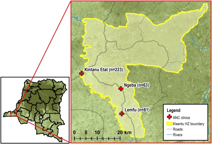
Figure 1.
Study sites: Kintanu Etat, Ngeba, and Lemfu antenatal clinics, Kisantu health zone, Kongo Central Province, Democratic Republic of the Congo. Clinic GPS points were collected by study authors. Basemap,25 road and river layers,26 and Kisantu health zone boundary layer27 all were sourced from open access imagery data. The map was generated with ArcMap 10.6 software (Esri, Redlands, CA). This figure appears in color at www.ajtmh.org.

