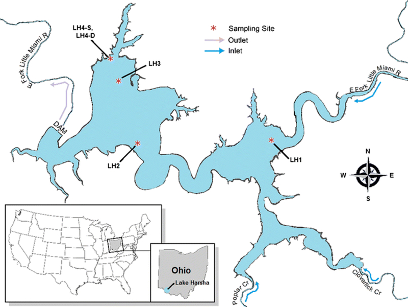
Fig. 1.

Map of Lake Harsha, Batavia, OH, showing the locations of the sampling sites. LH1 (lat. 39.022506, long. − 84.094618) is in the inlet basin of the lake. LH2 (lat. 39.02, long. − 84.1311) is at the entrance to the outlet basin of the lake, near the lake’s main beach area. LH3 (lat. 39.032506, long. − 84.137661) is in the outlet basin of the lake, near the dam and the intake tower for the Bob McEwen drinking water treatment plant. LH4-S and LH4-D (lat. 39.0367, long. − 84.1381) are at the intake tower, where samples were collected from the surface (LH4-S) and from a depth of ~ 7 m below the surface (LH4-D)
