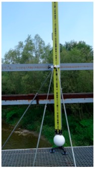
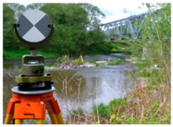
Table 6.
Diagram of the point cloud registration steps.
| Stage 1 | Tie Points | Georeference Data |

|
|
| 1 | HDS (High-Definition Surveying) targets |

|
(X, Y) of points of the control network | |
| 2 | white sphere targets 2 |

|
(X, Y) of sphere targets from the results of the first stage (H) of the centers of the sphere targets from precise leveling |
|
1 Based on [46]. 2 Device for stabilizing reference spheres on terrain surface protected by registered utility model No. W.126075, creator: Maria Makuch.
