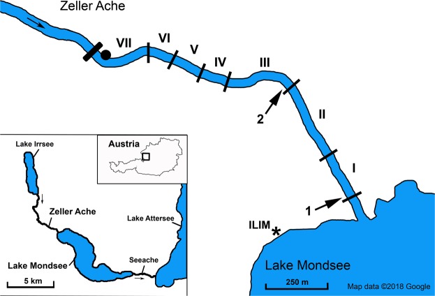
Figure 1.
Overview of the Natura 2000 region “Mondsee-Attersee” (Austria) with the river Zeller Ache on the north-eastern tip of lake Mondsee; investigated river sections of the Zeller Ache: I: outflow-section, II: section with paved riverbed and bank, III: preferred spawning ground in previous years, IV and VI: restructured river sections, VII: most distant section from outflow with impassable dam on upstream end, V: non-accessible section (ca. 100 m) (see Supplementary Information 1 for detailed description of the river sections). Arrows indicate locations of eDNA water sampling and physicochemical measurements (point 1 and 2); the dot marks the location of the automated discharge measurement station. The asterisk shows the location of the Research Department for Limnology, of the University of Innsbruck (ILIM). This map was modified from Google Maps (Google Maps. Mondsee, Austria. Retrieved October 8, 2018, from https://goo.gl/maps/817sNygimuThE58t7 (n.d.)) using Adobe Photoshop C2 Version 9.0.

