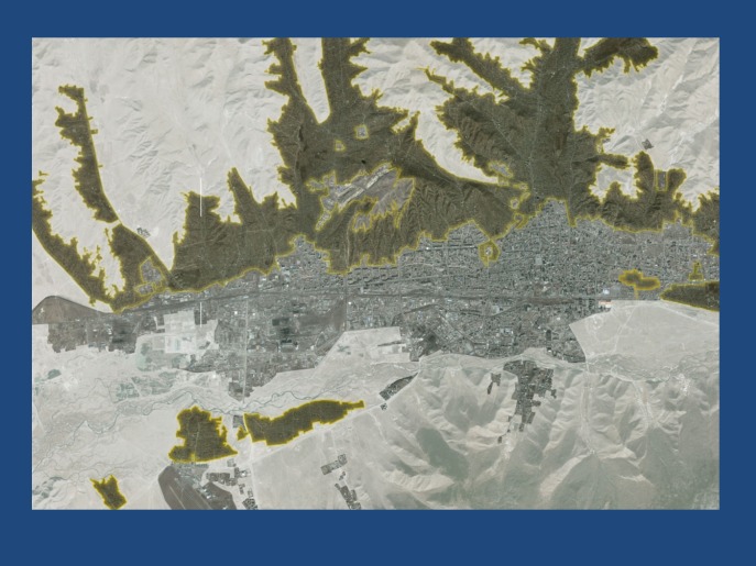
Figure 1.
Distribution of Ger districts, predominantly in the northern suburbs of Ulaanbaatar. Satellite view of greater Ulaanbaatar surrounded by snow (white). The centrally built environment that houses 40% of the total population in apartments is shown in gray. The surrounding dark green areas show the extent of the Ger districts that house the remaining 60% of the total Ulaanbaatar population of 1.5 million. The northern Ger districts contain approximately 200,000 family units, each living in a Ger and/or adjacent wooden shanties.

