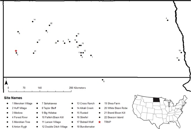
Figure 1.
Locations of sample sites within North Dakota and South Dakota, USA. Black circles indicate archaeological sites and a red star identifies the modern bison sample site, Theodore Roosevelt National Park (TRNP). Map layer sourced from: Esri, derived from Tomtom North America, Inc. “U.S. State Boundaries, North Dakota” [downloaded file]. Scale 1:4,750,000. “USA State Boundaries”. URL: https://www.arcgis.com/home/item.html?id = 540003aa59b047d7a1f465f7b1df1950. (September 9, 2019). This map was created using ArcGIS® software version 10.6 by Esri (www.esri.com).

