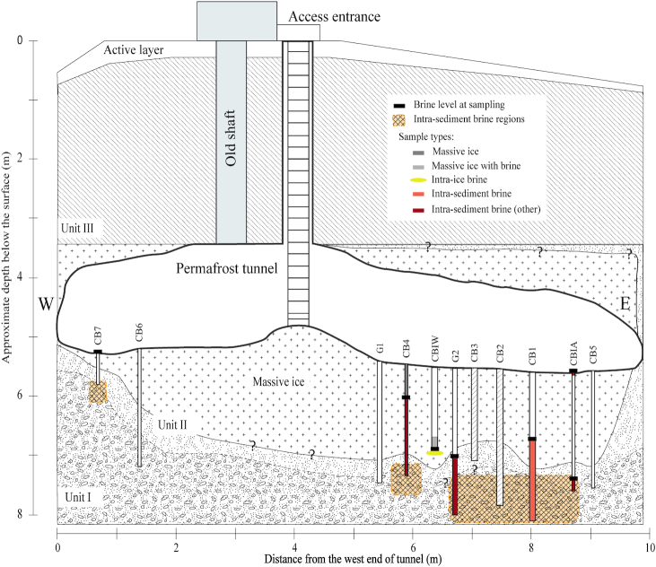
Figure 1.
North-facing cross-sectional diagram of the Barrow Permafrost Tunnel system. The tunnel is entered via the access ladder, and equipment and supplies are lowered through the same space. Cryopeg boreholes CB1, CB2, CB3 and the upper (dry) portion of CBIW were drilled prior to this study; CB2 ad CB3 were sealed and unavailable for this study. The other boreholes were drilled in 2017 and 2018, with pipes installed to preserve the holes and facilitate sampling. Crosshatched sections indicate confirmation of cryopeg sediments (intra-sediment brine regions). Units I–III refer to permafrost regions, following Meyer et al. (2010a). W and E indicate West and East directions, respectively. Question mark symbols ‘?’ indicate unresolved boundary position. See Table 1 for sample details, and Text S1 (Supporting Information) for borehole terminology and drilling details.

