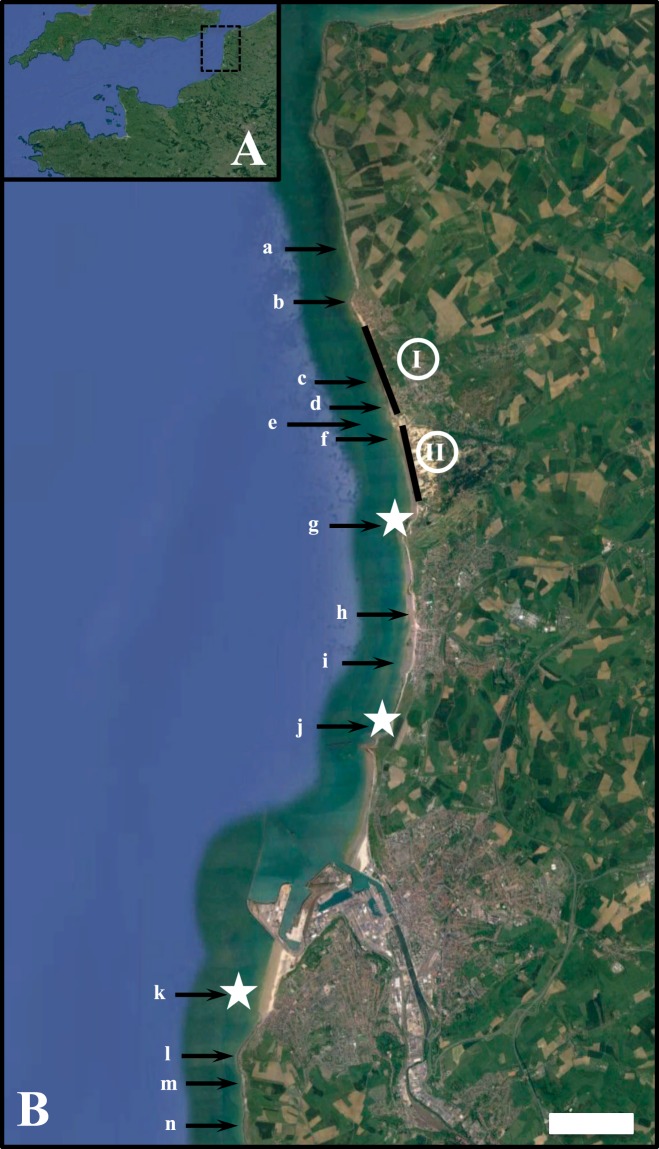
Figure 2.
Localisation of the 14 M. edulis beds documented along the French side of the English Channel (black arrows), shown together with the accumulation of empty dead shells as localised spots (white stars) and stretched along kilometres of coastlines (black lines). The numbers I and II respectively identify the northernmost and southernmost stretches of beaches where dead M. edulis heavily accumulated along the high-tide marks. The scale bar represents 1 km. Map data: Google, SIO, NOAA, U.S. Navy, NGA, GEBCO, Image Landsat/Copernicus (A), and Google, SIO, NOAA, U.S. Navy, NGA, GEBCO (B).

