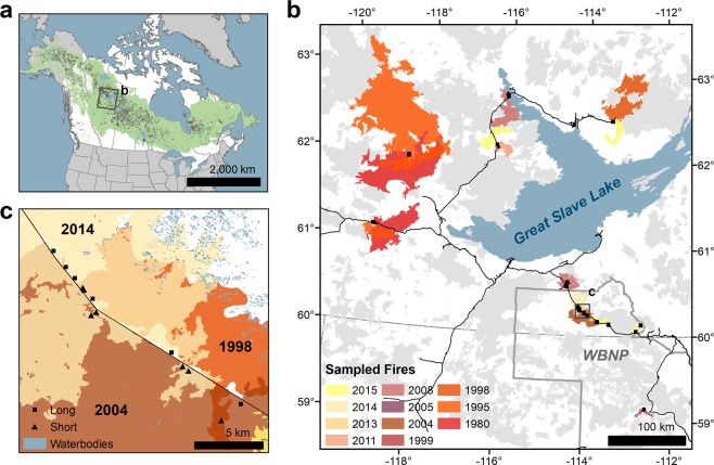
Figure 1.
Location and fire history of the study area. (a) Recent (1984–2016) Canadian67 and Alaskan (USA)76 fire perimeters (grey) in the context of the North American boreal forest (green)77. The extent of panel (b) is indicated with a black rectangle. (b) The distribution of sampling sites in the study area. Sites are identified as black squares. Sampled wildfires are coloured by year of occurrence and superimposed on wildfires that occurred in the recent past (1980–2015; grey) on the landscape at the time of sampling. Wood Buffalo National Park (WBNP) is outlined in grey, major roads are shown in black, and the extent of panel (c) is indicated with a black rectangle. (c) Detailed area showing an example of the sampling design of paired sites with short and long fire-free intervals.

