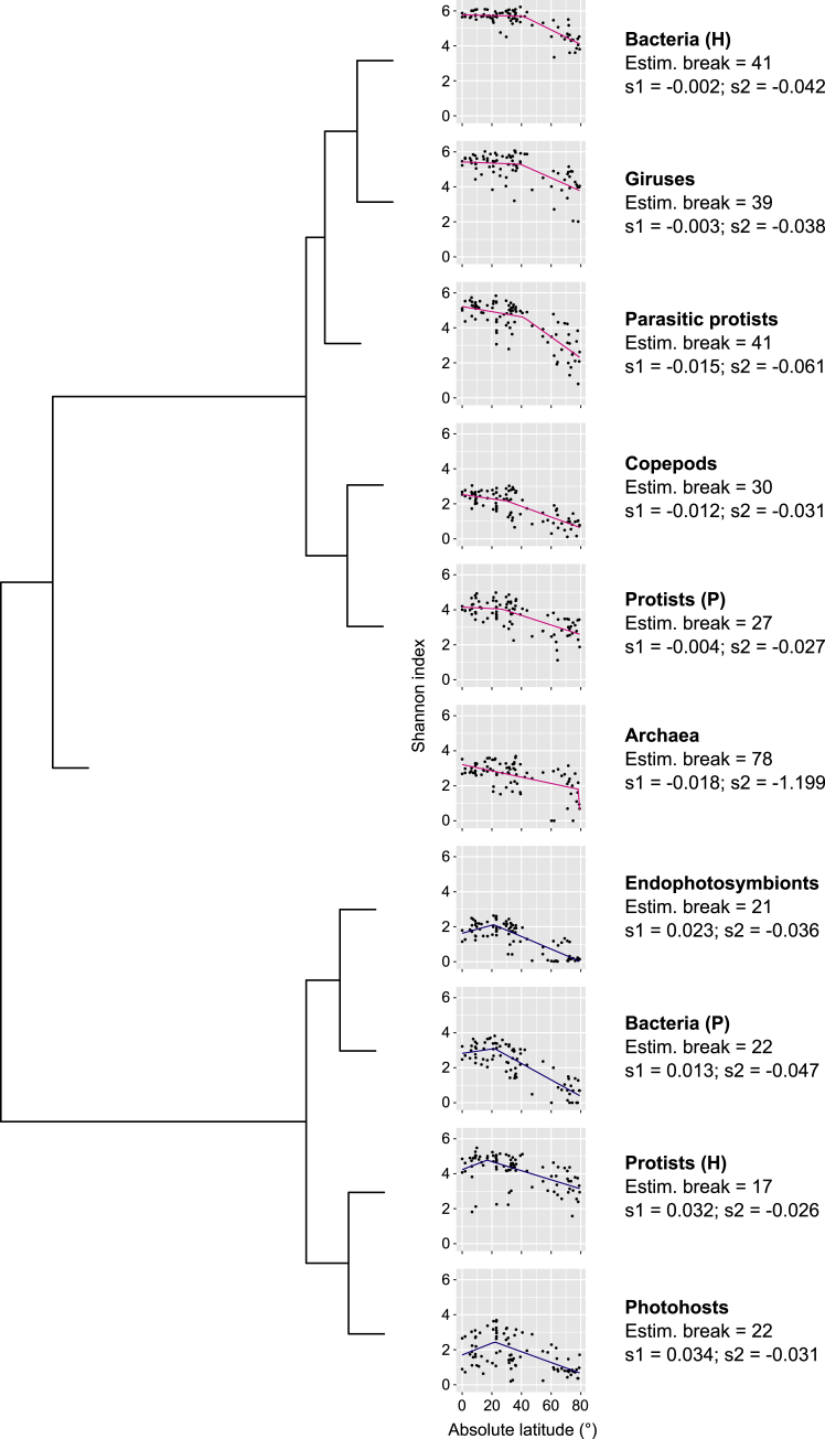
Figure S5.
Classification of MPG Sea Surface LDG Analyzed by Segmented Regression, Related to Figure 2A
The estimated break is the absolute latitude between the two segments of slope s1 and s2, respectively. We used pink lines for s1 ≤ 0 (plateau or peak around the equator) and blue lines for s1 > 0 (extra-equatorial peak). The dendrogram is the result of a hierarchical clustering based on the differences in break and slope values across MPGs (Euclidean distance on standardized values).

