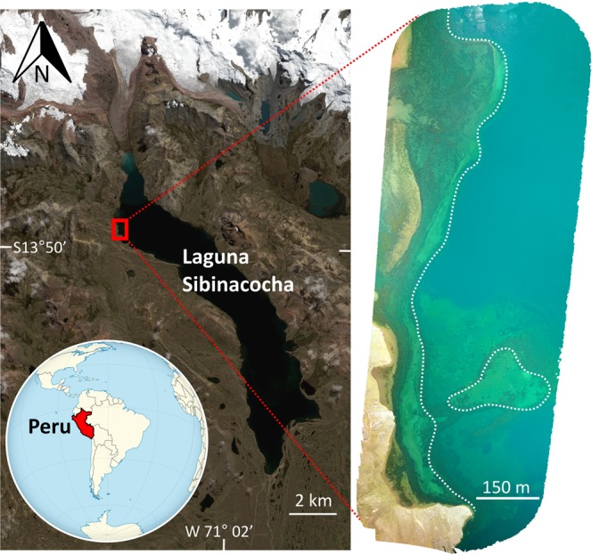
Figure 1.

Location of Laguna Sibinacocha in the Peruvian Andes showing the region of the lake where the study pot was recovered (red rectangle). Unmanned aerial vehicle (UAV) imagery of the study region (right image) reveals a probable former shoreline prior to flooding, demarcated by a dotted white line. The paleo-shoreline generally follows the submerged beach berm running parallel to the current shoreline. Former channels and delta features are also evident in the upper portion of the image. The exact location of the study pot is not shown in order to protect the archaeological site. Satellite imagery of Laguna Sibinacocha and its surroundings was provided by DigitalGlobe Foundation. UAV imagery was processed using Maps Made Easy (https://www.mapsmadeeasy.com/).
