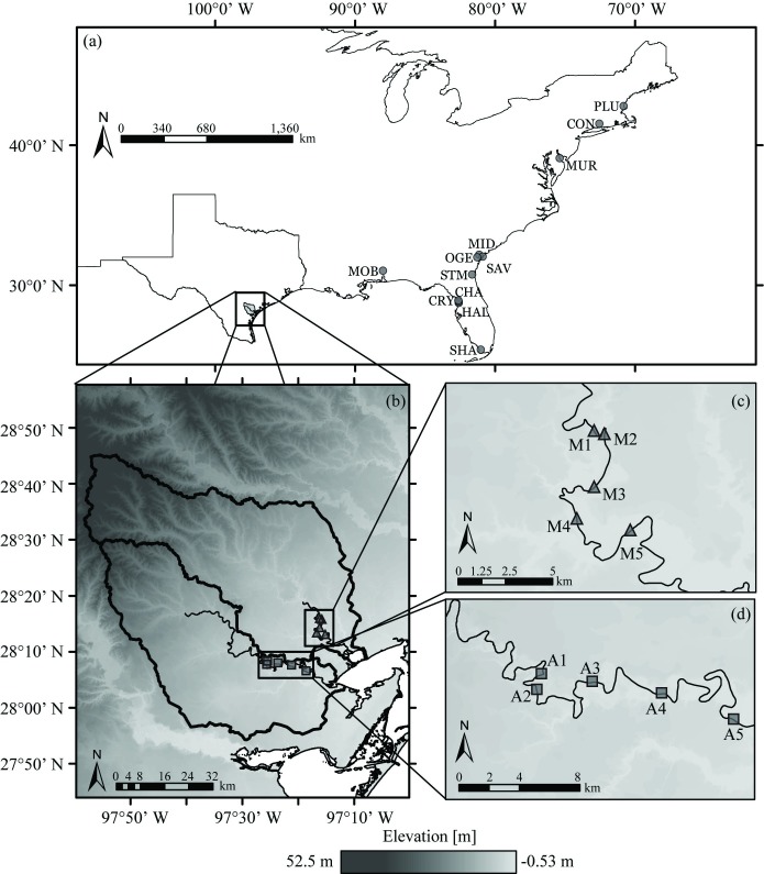
Fig 2. Locations of the tidal rating curve model validation and application sites.
The 12 tidal USGS gauges available nationally with appropriate data for validation were located throughout the eastern US (circles in a) [51]. The ten original model application sites were on the Mission (triangles in b,c) and Aransas (squares in b, d) Rivers of the Texas Gulf Coastal plain, distributed throughout the tidal freshwater zone of each river [16]. Elevation data, watershed boundaries, and river lines were obtained from U.S. Geological Survey, National Geospatial Program [52]. The Texas state and U.S.A. country outline was obtained from the U.S. Census Bureau [53]. Both the National Geospatial Program and the U.S. Census Bureau provide public access to their data sets. Data visualized using ESRI ArcGIS software.

