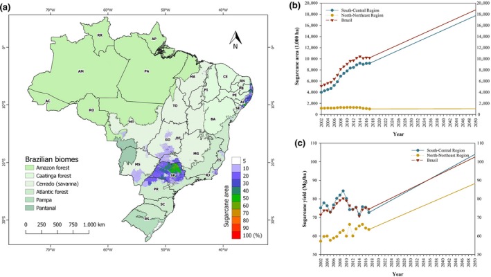
Figure 1.

Sugarcane cultivated area in percentage of pixel area (resolution 1 × 1 km), highlighting the two largest sugarcane‐producing regions (South‐Central and North‐Northeast) (a). Sugarcane cultivation map was built from updated dataset provided by Dias, Pimenta, Santos, Costa, and Ladle (2016) (http://www.biosfera.dea.ufv.br). Current and future (2019–2050) trends in Brazil's sugarcane area (b) and yield (c)
