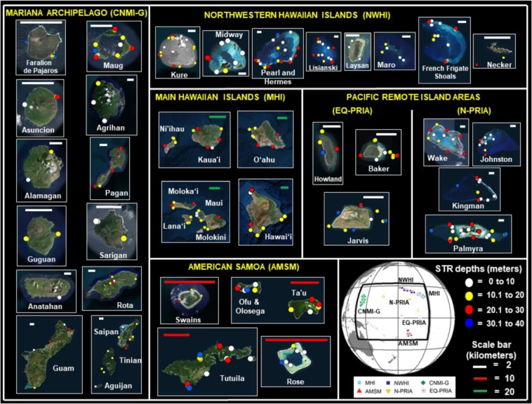
Figure 1.
Subsurface temperature recorder (STR) study sites monitored by NOAA’s Pacific Reef Assessment and Monitoring Program (Pacific RAMP) in the six archipelagic regions: The Commonwealth of the Northern Mariana Islands and Guam (CNMI-G) with 17 islands (subsurface Santa Rosa Reef, Supply Reef, and Zealandia Bank not shown); the Northwestern Hawaiian Islands (NWHI) with nine islands (Gardner Pinnacles not shown); the Main Hawaiian Islands (MHI) with 10 islands (Lehua and Five Fathom Pinnacle not shown); American Samoa (AMSM) with six islands (South Bank not shown); the Northern Pacific Remote Island Areas (N-PRIA) with four islands; and the equatorial Pacific Remote Island Areas (EQ-PRIA) with three islands. A total of 1076 individual STR were deployed in depths ranging between 1 and 38 m at a total of 492 coral reef sites distributed among 49 islands in the six regions. Circles indicate the 457 sites with at least 365 consecutive days of data analyzed in the study. Color in circles represent STR deployment depths in meters (White = 0 to 10, Yellow = 10.1 to 20, Red = 20.1 to 30, and Blue = 30.1 to 40). Overlapping in the location of STRs (circles) is due to instrument proximity. Global map insert shows the location of the 457 sites at the six regions, and their associated names and symbols. The maps were generated by using the free version of Google Earth Pro (https://www.google.com/earth) with data from the following providers: Image Landsat/Copernicus, Image @2019 Maxar Technologies, and Image @ 2019 CNES/Airbus. The NOAA Pacific RAMP STRs location is overlapped to the individual maps.

