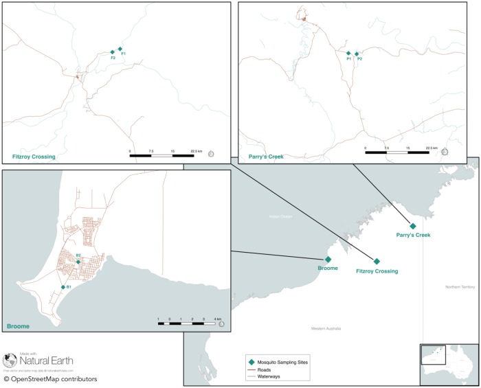
Fig 1. Map of northern Western Australia.
Mosquito trap locations for three sites are marked with a green triangle. The inset maps indicate the locations of each of two traps located at each site. Map prepared using QGIS v2.18.15 (http://qgis.osgeo.org), OpenStreetMap, Natural Earth, and Mainroads Western Australia (https://portal-mainroads.opendata.arcgis.com/). The baselayer shapefile was obtained from the Australian Government data portal (https://www.data.gov.au/).

