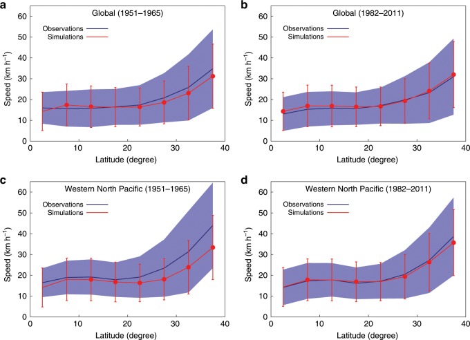
Fig. 2. Global and Western North Pacific basin mean tropical cyclone translation speed against latitudes from the observations and simulations.
a–d The range of the latitude is 0–40° with 5° interval. Navy blue (red) line is for the observations (simulations). Vertical shading (bars) indicates 1 standard deviation in the bins for the observations (simulations). The latitudinal distribution is shown for the global data over the pre-satellite era (a) and over the post-geostationary satellite era (b), and for the Western North Pacific basin data over the pre-satellite era (c) and over the post-geostationary satellite era (d). Red dots mean the difference between the observations and simulations is statistically significant at a 99% level (p < 0.01, two-tailed Student’s t test).

