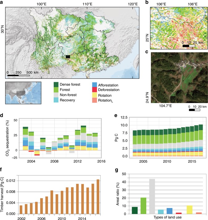
Fig. 4. Land use in southern China.
a The area classified into the eight types of land use. b Forestry is particularly common in northern Guangxi. This close-up is shown as a black rectangle in a. c Forestation of farmlands on sloping hills is a major reason for the increase in forests. This example image (GF-1, 2-m resolution) is also from northern Guangxi (not the same area as b). d Contributions of the types of land use to store fossil CO2 emissions for the eight provinces in southern China (considering net C changes) from 2002 to 2015. e C stocks for the types of land use from 2002 to 2017. f Annual timber harvest (from forestry statistics at province level; n = 8) converted to Pg C. g Areal ratios of the types of land use. See Supplementary Figs. 5, 6 for close-up illustrations. Source data are provided as a Source Data file.

