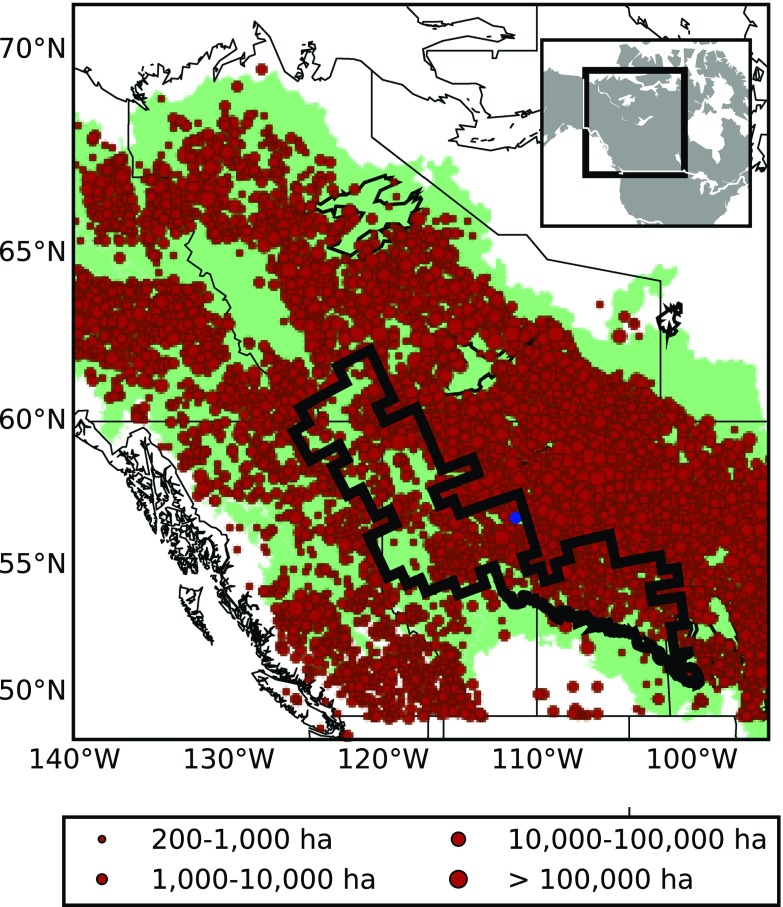
Fig. 1.
Western Canada region used in this study. The green shading represents the Boreal zone (Brandt 2009). Red points are ignition locations of large fires (> 200 ha) for the 1980–2014 period from the CNFDB, scaled by fire size. Black region is HFR9 and the blue dot is Fort McMurray

