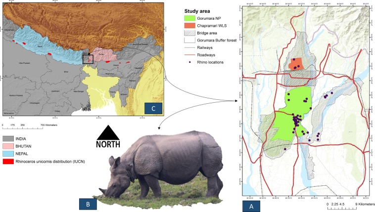
Figure 1.
Showing study area map. (A) Showing Gorumara National Park (GNP), Chapramari Wildlife Sanctuary (CWLS) and Bridge area along with road and rail network in red and black lines respectively. Background topographic surface has been created by adding ESRI base map (Topographic) in ArcGIS 10.6. (B) Field picture of one-horned rhino (Rhinoceros unicornis) in its natural habitat of GNP. (C) The extant distribution of one-horned rhino (Rhinoceros unicornis) as per IUCN. (Maps are generated using ArcGIS 10.6: www.esri.com).

