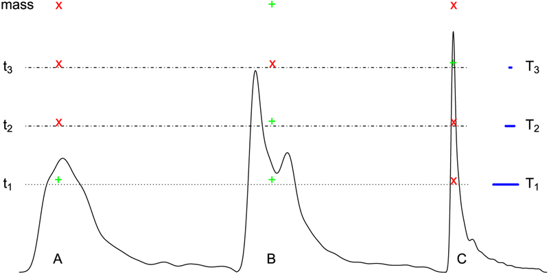
Fig. 1.
Schematic illustration of handling multiplicity via neighborhood leveraging procedures. The process is illustrated by considering three hypothetical spatial clusters that can be imagined as three sub-continental landmasses. The “pass” or “fail” of a cluster depends on its size (cross-section extent) at a particular voxel-wise threshold (or sea level; showcased by the blue segment length of T1, T2 and T3). In other words, only the neighborhood defined by that particular threshold matters in the sense that the spatiotemporal information contained in the data is summarized by a snapshot (a cluster defined by a cutoff). At the level of t1, clusters A and B survive (green “+” sign) based on the spatial threshold T1 while C does not (red “×” sign) because of its small size. In contrast, at the stringent level t3, both clusters A and B fail while C survives. Note that the surviving clusters strongly depend on the “sea level” adopted, and no single case is ideal. In particular, if an anatomical region is intrinsically small, clustering will often fail to reveal it unless the statistical evidence is unusually strong.

