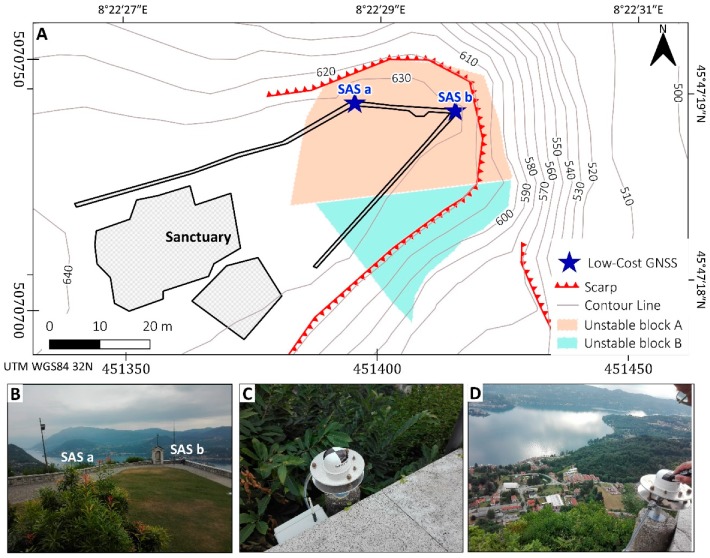
Figure 5.
(A) shows the location on maps of Global Navigation Satellite System GNSS antennas “SAS a” and “SAS b” with latitude-longitude (upper right) and UTM WGS 84 (bottom left) coordinates; (B) a picture shows the location of antennas from the courtyard perspective; (C) the photo shows a detail of “SAS a” antenna [451401.968 E, 5070726.618 N, 682.378 h–WGS4 32 N]; (D) shows a detail of “SAS b” antenna SAS b [451384.123 E, 5070731.990 N, 683.187 h–WGS4 32 N].

