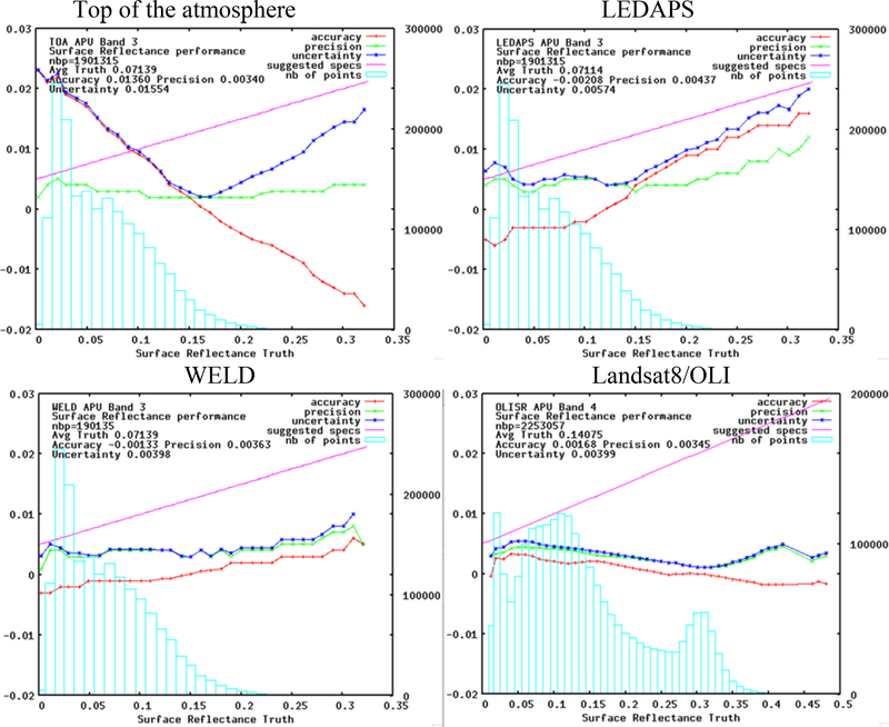
Figure 4:
Comparison of the Accuracy, Precision and Uncertainty of the different surface reflectance products in the red band, LEDAPS (Landsat 7/ETM+), WELD (Landsat7/ETM+) using MODIS aerosol and Landsat8/OLI (this work). The reflectance truth is obtained by correcting the TOA reflectance with 6SV using AERONET as input for water vapor and aerosol. For reference also shown is the performance of the top of the atmosphere data (same dataset as LEDAPS and WELD). The blue bars show the number of point used in each bin of reflectance. The pink line represents the specified uncertainty based on a theoretical error budget of the collection 5 MODIS surface reflectance. The time period and sites used for Landsat8/OLI are different than the ones used for LEDAPS, WELD and TOA datasets.

