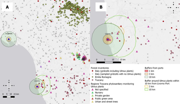
Figure E.2.

Panel A: Spatial distribution of elm trees (Ulmus sp.) of unknown stem diameter in the vicinity of Northern Italian ports of La Spezia and Livorno (blue stars) being locations of plausible pest interception. Different assumptions of flight capability are represented by radial distance of 1 km (red area), 3 km (orange area) and 10 km (green area) to the port of La Spezia (left top) and Livorno (middle bottom). Additionally, in Panel B, secondary distances are encircled by dotted lines representing the available host for further spread once established on any elm in the surroundings of the two ports. Symbols related to the Italian Forest Inventory represent the south‐west corners of 1 km x 1 km grid cells including (red circles) or not (grey crosses) Ulmus plants. Squares indicate centroids of polygons (Emilia Romagna) or grid cells (Tuscany) with records of the presence of Ulmus plants. Triangles represent Ulmus plants inspected within the Tuscany phytosanitary monitoring programme
