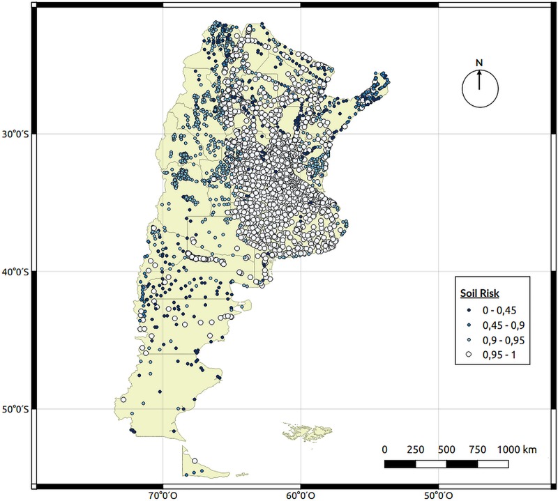
Fig 5. Soil characteristics (SC) risk map.
Each point represents a city and the different characteristics of the soil were obtained from a Soil Atlas of Argentina from the National Institute of Agricultural Technology. Map created using QGIS Geographic Information System. Open Source Geospatial Foundation Project. http://qgis.osgeo.org.

