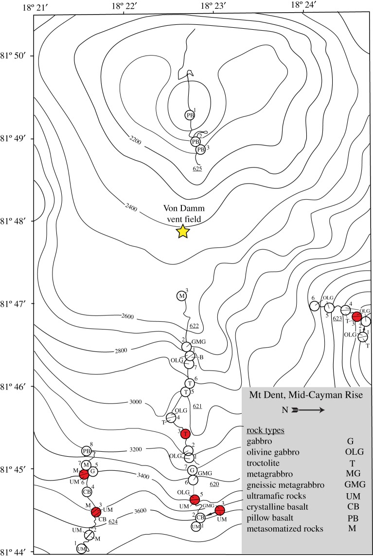
Figure 1.
Bathymetric map of the eastern flank of the Mount Dent oceanic core complex on the Mid-Cayman Rise showing the locations of dive tracks and stations from the Cayman Trough Project. The distribution of rock types is shown for each numbered station. Samples used in this study are displayed as red circles. The approximate location of the Von Damm hydrothermal field (yellow star) is shown for comparison. Figure modified from Stroup & Fox [27]. (Online version in colour.)

