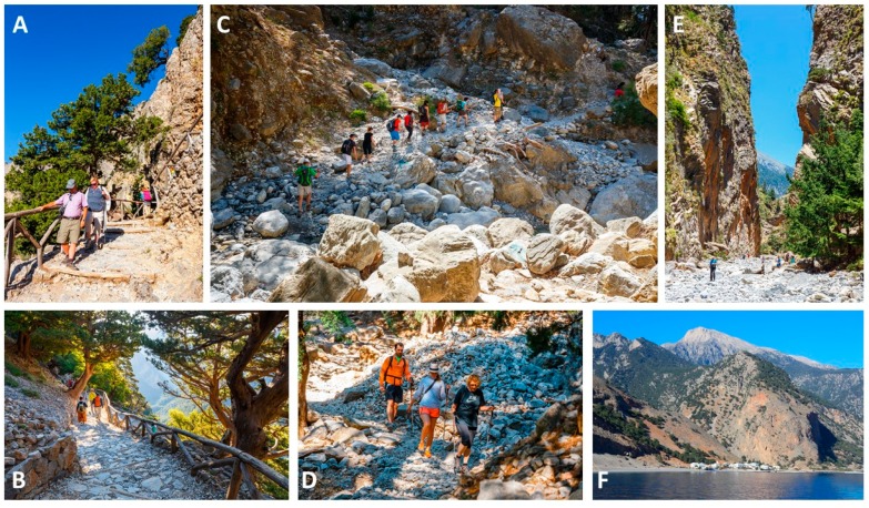
Figure 2.
Impressions of the Samaria Gorge walk. (A,B) Over the first kilometers, participants descend a narrow switchback path, which is partly bordered by a wooden handrail. A large part of the walk is trough rough terrain, i.e., the slippery stones of a dried-up riverbed. In winter, the riverbed is filled with water, but in summer the river has mostly dried up. Participants cross the riverbed several times, sometimes aided by wooden improvised bridges. (C,D) there is no paved road but participants have to follow a trail through a rocky valley. Samaria is the main resting place for most participants, as this uninhabited tiny village contains benches in the shade, a water tap point and a medical post. Through the last part of the walk, the cliffs become higher and narrower. (E) At its narrowest point, called the “Gates”, the Samaria Gorge is approximately 4 m wide, while the cliffs rise over 300 m high. (F) Thereafter, the final fairly flat part of the walk ends in Agia Roumeli at the seaside. Participants can relax, eat and drink in the taverns, and recover from the walk. From Agia Roumeli, a ferry brings the participants to Hora Sfakia in about 1 h. From there, coaches leave at 18:00 to bring the participants back to their accommodation. Figures adapted and used with permission from www.depositphotos.com.

