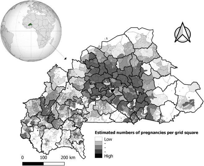
Figure 1.
Map of Burkina Faso with small administrative divisions nested to health-districts areas and Spatial pattern of estimated pregnancies per grid square. Black bold lines correspond to limits of the health-districts and gray lines in each health-district correspond to limits of communities. Maps created by Toussaint Rouamba et al., 2019. Source: The shapefile was obtained from the “Base Nationale de Découpage du territoire” of Burkina Faso (BNDT, 2006). The estimates of numbers of pregnancies per grid square were obtained from WorldPop (www.worldpop.org - School of Geography and Environmental Science, University of Southampton). The globe (name: orthographic map of Burkina Faso) used in this Figure is created by Martin23230 and freely available at https://commons.wikimedia.org/wiki/File:Burkina_Faso_(orthographic_projection).svg under CC BY-SA 3.0 License (https://creativecommons.org/licenses/by-sa/3.0/deed.en), which lets others remix, tweak, and build upon their work even for commercial purposes, as long as they credit author and license their new creations under the identical terms.

