
Figure 2.
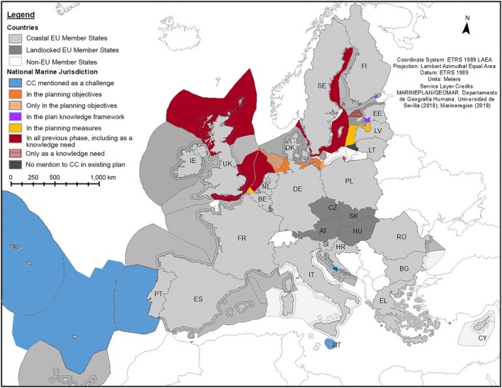
How climate change (CC) is addressed in marine spatial plans in EU marine waters. Colors in the map represent the phase(s) in the planning where climate change is considered/mentioned in marine spatial plans. Phases of the plans are a synthesis from Ehler and Douvere (2009). Gray shows the countries that are in the process of preparing their marine plans according to the EU Directive 2014/89/EU and do not have an approved plan yet. Dark gray shows the marine waters of Lithuania, where the existing marine spatial plan does not mention CC.