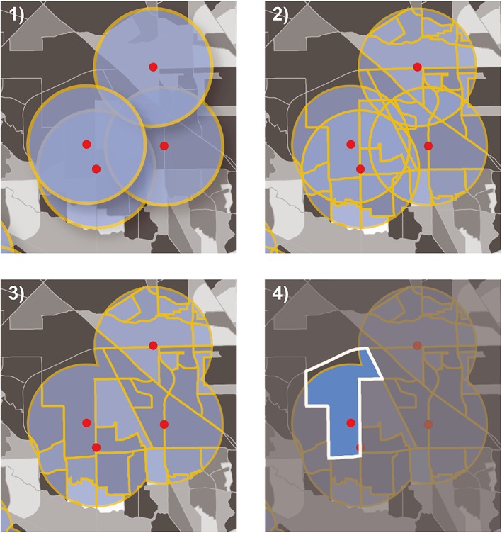
Figure 1.

Illustration of the analytical steps taken in ArcGIS to determine population, educational facilities, and medical facilities within 1.5 miles of a highly hazardous chemical facility: (1) Draw 1.5‐mile buffer; (2) divide buffers by census block boundaries; (3) dissolve buffers by GeoID to eliminate overlap; and (4) calculate percentage of each census track located within the buffer region. This percentage was then multiplied by the population of the census block, assuming the population was distributed evenly throughout the block group. We then performed a spatial join between the dissolved buffer layer and point locations of medical and education facilities. RSEI = Risk Screening Environmental Indicator.
