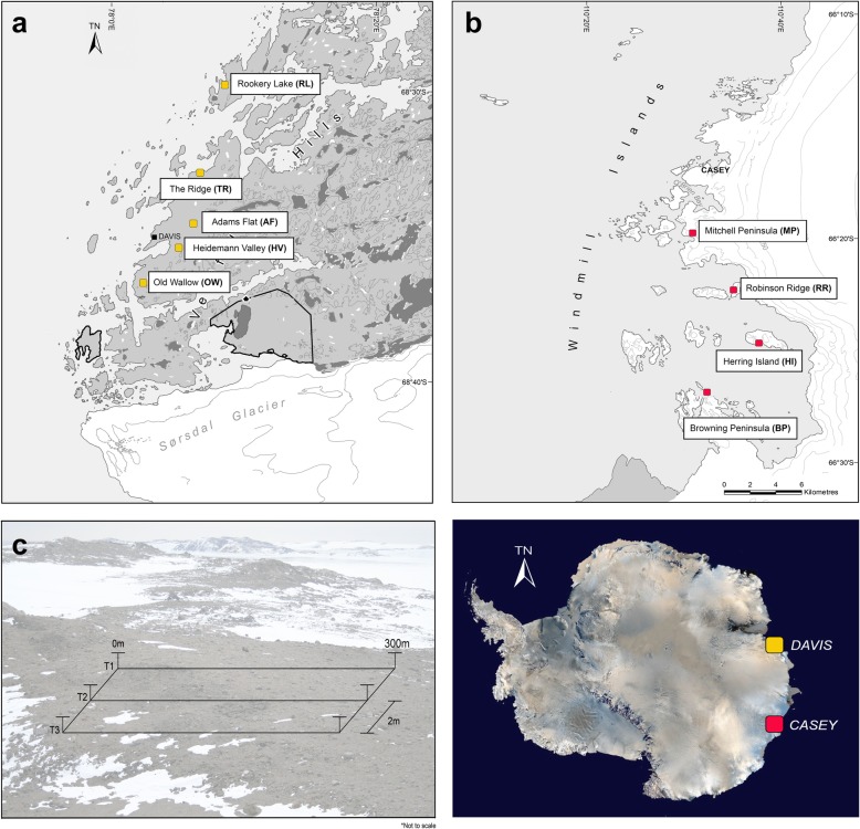
Fig. 5.
Map of the nine study areas across the a Vestfold Hills (AAD map catalogue No. 14, 499) and b Windmill Islands (No. 14, 179) region of Eastern Antarctica, showing approximate sampling locations and c geospatial transect design. At each site, soil samples (n = 93) were taken at the following distance points along each transect: 0, 0.1, 0.2, 0.5, 1, 2, 5, 10, 20, 50, 100, 100.1, 100.2, 100.5, 101, 102, 105, 110, 120, 150, 200, 200.1, 200.2, 200.5, 201, 202, 205, 210, 220, 250 and 300m. Where underlined distance points refer to a subsample (n = 18) submitted for amplicon sequencing of eukaryotic (18S rRNA) and archaeal (16S rRNA) soil communities

