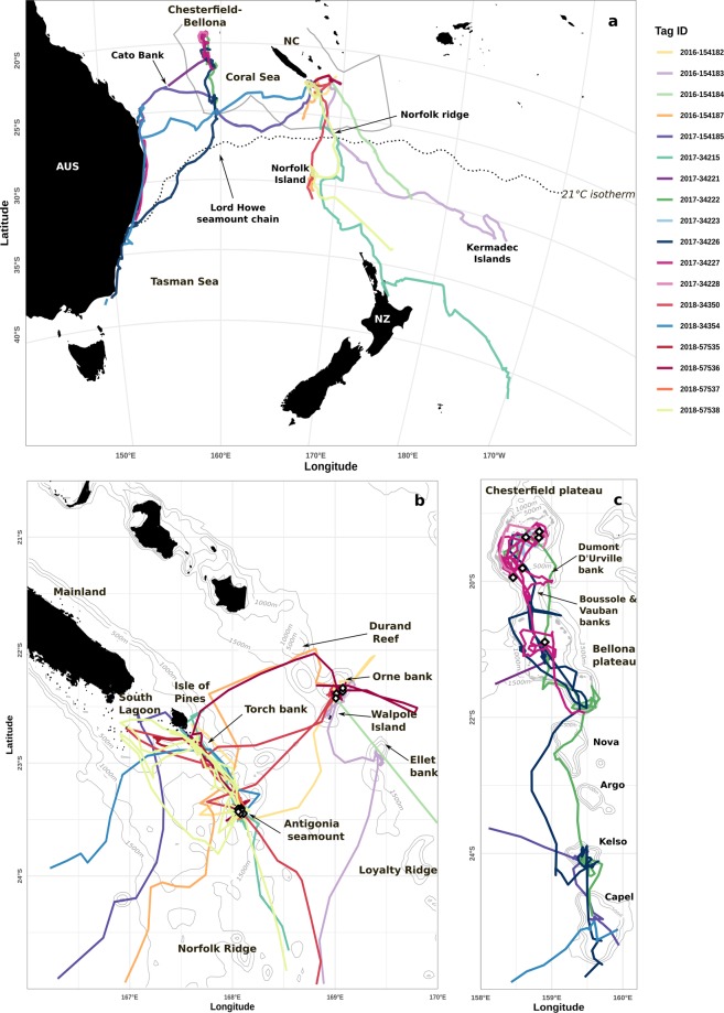
Figure 1.
Satellite tracks recorded from 18 SPLASH10 tags deployed on humpback whales in New Caledonia. (a) Regional view (with southern borders of the Natural Park of the Coral Sea in grey) showing Australia (AUS), New Zealand (NZ) and New Caledonia (NC); (b) Zoom on Southeastern New Caledonia (Norfolk and Loyalty ridges); and (c) Zoom on the Chesterfield-Bellona coral reef complex and Lord Howe seamount chain. Grey lines represent 500 m isobaths up to 2000 m deep. Land is shown in black. The locations of tag deployments are shown with white diamond shapes. The breeding study region is demarcated by the 21 °C isotherm shown with a dotted line in (a).

