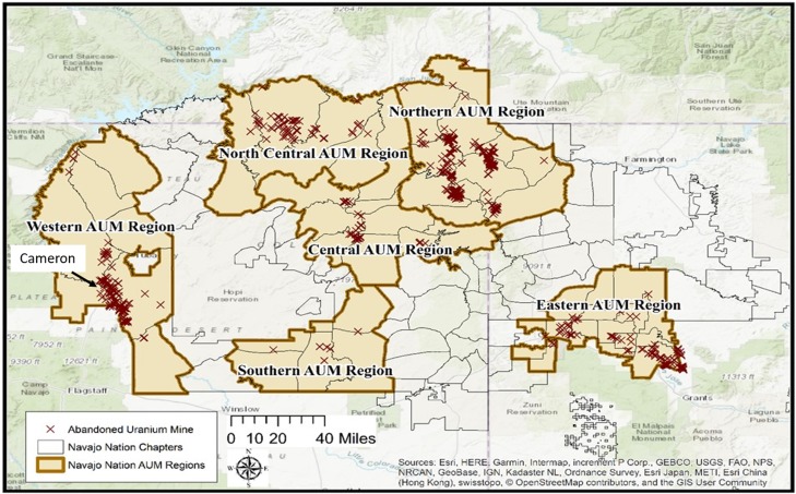
FIG. 1.
Map of the Navajo Nation with the abandoned uranium mine sites represented by “X’s” and the Navajo Agencies and Chapters outlined within the map (Ref. 8) [OSM Map On Garmin. (May 13, 2019). OpenStreetMap Wiki. Retrieved 10:12, June 12, 2019 from https://wiki.openstreetmap.org/w/index.php?title=OSM_Map_On_Garmin&oldid=1851574].

