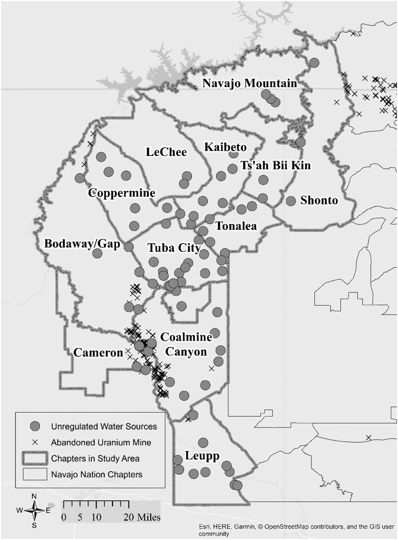
FIG. 2.
Western Agency Navajo Nation Chapters with the location of unregulated water sources sampled and abandoned uranium mine structures [OSM Map On Garmin. (May 13, 2019). OpenStreetMap Wiki. Retrieved 14:25, July 23, 2019 from https://wiki.openstreetmap.org/w/index.php?title=OSM_Map_On_Garmin&oldid=1851574].

