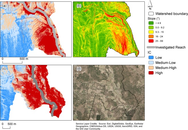
Figure 3.
Various landscapes features [high slope (b), and agricultural fields (d)] increase landscape connectivity (more extensive areas with high values of the connectivity index -IC-), determining the amount of rainfall to be transformed into runoff and sediment to be possibly delivered to the river reach, and therefore influencing flood risk. Examples are shown for the Cadwell (a,b) and Salmon Creek (c,d) watersheds. The figure was arranged using ArcGis 10.7 [www.arcgis.com]. Slope was evaluated using customized scripts in Matlab 2018b [https://www.mathworks.com/release2018b], while the connectivity index was derived using the stand-alone tool by133.

