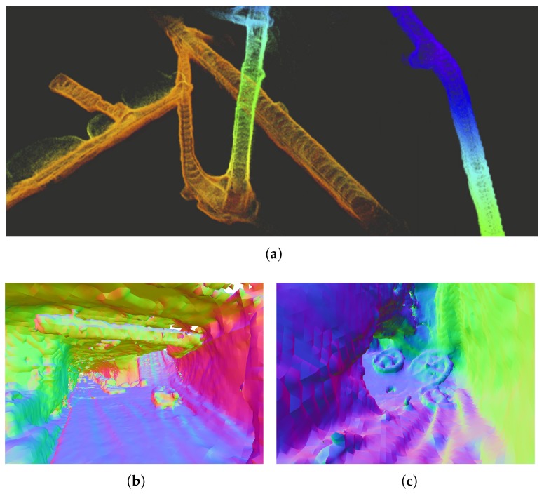
Figure 11.
3D reconstruction of an underground mine in Gonzen CH based on LiDAR data with poses provided by VI SLAM [27]. (a) Accumulated points clouds using only VI SLAM poses; (b) Dense reconstruction example based on [30]; (c) Visible details of wheels lying on the ground using den se reconstruction based on Reference [30].

