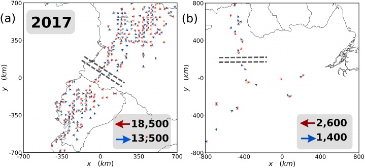
Fig 3. Crossing routes.
Map of two main ground migrant exit routes from Venezuela reported by official agencies: in (a) the Pan-American road with a portion of Colombia, Ecuador and Peru, and in (b) the area of Roraima, Amazonas and Pará states in Brazil. Blue arrows indicate flows toward Venezuela and the red ones away from it. Only cells with more than three TUVs are shown in the maps. The lightness of the color of the arrows is proportional to the net in- and out-flows from light to darker colors. The upscaled net flows crossing the dashed lines are displayed in the right-bottom corner of each plot.

