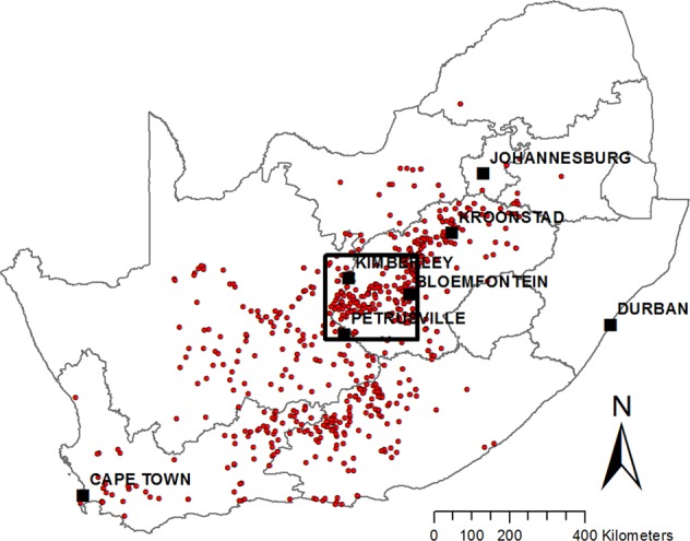
Figure 1.

Study area (black rectangle) showing major towns and locations of the RVF outbreaks reported to the OIE during 2010–2011 (red points). The map was constructed for this publication in Esri ArcGIS 10.2 (https://www.esri.com) using country and province boundaries from Esri ArcGIS Online (https://www.esri.com/en-us/store/arcgis-online). Locations of 2010–2011 RVF outbreaks were obtained from http://www.oie.int/wahis_2/public/wahid.php/.
